
| Ascent route is marked with the red line. I started below the treeline at an altitude of 5,500 ft, when I woke-up at 5:00AM it was raining so I put off starting until 6:35AM. |

|
|
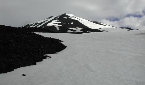
I'm at 8,500 ft and the clouds have not yet overtaken the summit. There were a group of snowboarders camping out just to the left, outside the cameras view. |
| An old abandoned house sits on the summit. I reached the summit (12,276 ft) at 12:40PM, by this time it was too cloudy to see much. |

|

|
This photo taken on the summit shows the final ascent route with the false summit in the distance. |
| Picture is looking east of the summit. |

|

|
If you compare this photo, taken after I decended, with the third photo in this sequence you can see just how cloudy it was on the summit. |