.TOURING
COLORADO GEOLOGY

(part 1)
|
|
.TOURING COLORADO GEOLOGY |
|
|
(part 1) |
||
| Just east of Gunnison about 8 miles along Highway 50, Colorado 114 heads south to Saquache. The road is fairly narrow (compared to Hwy 50) and rough even though it is paved, but makes for an enjoyable drive with lots of geology. |  |
 |
As I said, turn south onto Hwy 114, first crossing Tomichi
Creek, then Cochetopa Creek, you travel fairly straight for about 2 miles
before entering a relatively narrow canyon with a very curvy road which
follows Cochetopa Creek. Most of these rocks are dark metamorphic
schists. The foliation is almost vertical and creates some very
striking outcrops.
At Mile Marker (MM) 5, you cross the Cochetopa Creek again. The rocks through this area continue to be dark metamorphic schists. At MM 8, we leave Gunnison County and enter Saquache County. Throughout this area small uranium mines of the 1950's can be found. |
| Between MM 13 and 14, the rocks change to red granite (Cochetopa Granite). Exposures along the road are quite dramatic with steep cliffs and interesting jointing patterns. There are a number of small pulloffs along the canyon and creek. |
 |
|
|
|

|
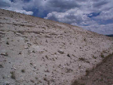
By MM 18 you leave the canyon and enter into a broad valley
which is strikingly different from what we were just driving through. This
broad valley is actually a caldera, one of 15 that have been
identified in the San Juan Mountain region. Outcrops of white
volcanic tuff occur along the road. The caldera is about 24 km
across formed during ...
|
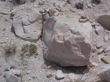
Off to the right (south) is the very prominent Cochetopi
Dome. As you start to climb out of the caldera, the rocks change
from the very white tuffs to reddish-brown tuffs, some filled with large
rock fragments reminiscent of the West Elk Breccia although the fragments
are much smaller in size.  |
 |

|
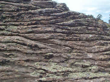
As you continue up toward Cochetopa Pass (3093 m), the tuffs
alternate with basalts some of which show some very nice columnar
structures. These "columnar basalts" are formed due to
cooling and contraction of the basalt as it cooled. The joints are
formed perpendicular to the cooling surface; their size (diameter) is
interpreted to be related to the rate of cooling. The faster the
basalt cooled, the smaller the columns. These are relatively small
(5 to 6 inches in diameter) compared to some much more notable columnar
basalts such as the Devil's Postpile in California, Devil's Tower in
Wyoming and the Giant's Causeway in northern Ireland. The best
are between MM30 and 31 and again on the other side of the pass between MM
33 and 34.  |
| This whole area is quite complex with lots of different episodes of eruptions expressed by different tuffs, some air-fall others water-laid along with mudflows and biotite-hornblende dacite. |  |
 |
At MM 37, at the intersection with Road 31CC to North Park and Spanish Creek goes off to the left. Here are some really bizarre outcrops of the Fish Canyon Tuff. The Fish Canyon is a crystal-rich quartz latite ash-flow. The structure referred to as "beehive" is probably due to crude wide columnar jointing and wavy compaction layering. |
 |
 |