.TOURING
COLORADO GEOLOGY

|
|
.TOURING COLORADO GEOLOGY |
|
|
|
||
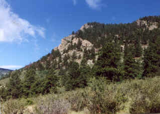
| BAILEY TO KENOSHA PASS | We resume our trip west along 285 at the base of Crow Hill just on the east side of Bailey. |
| Bailey is a small mountain community whose "downtown" has 3 restaurants, 1 gas station, a lumber yard, post office, and a few other shops. The Platte River flows through the town on the left of the road as you are heading west. | |
| Watch your speed through the town, its only 40 mph! | |
|
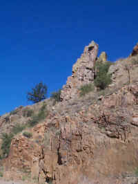
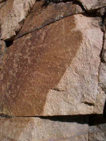
The outcrop pictured to the left is pretty typical of the rocks through town. The rocks exposed in the outcrops are metamorphic schists and gneisses. They are the same as we saw at the top of Crow Hill at the end of our 1st tour. They are Pre-Cambrian in age approximately 1.4 to 1.7 billion years old. |
| Continuing west, we travel through a fairly narrow canyon for the 3 miles.
The road you are driving on is the bed of the old railroad line (Denver South Park
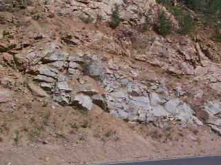
and Pacific Railroad) that once serviced this area. Metamorphic rocks continue to outcrop on both sides of the road as we drive west. The outcrop to the right is located on the north side of 285 just west of Bailey at mile marker 221. |
|
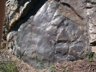
| On the left is Glen Isle, a historic lodge built in 1901. It is listed in the National Register of Historic Places. Below is a detail from the preceeding outcrop. According to Hutchinson "Ptygmatic folds have been developed in weakly foliated gneiss."
|
This outcrop is 1 mile further west along 285 (mile marker 220). Here we see basically the same metamorphic rocks as in the preceeding outcrop except deformation has resulted in some interesting features. |
|
This detail shows a separation of felsic and ferromagnesian minerals resulting in a number of lenses of dark ferromagnesian minerals "floating" in lighter-colored felsic minerals. |
We also can see some interesting deformation in these closeups in the same outcrop.
|
| OK, had enough of gneisses and schists? TOO BAD, we will continue to see these for many more miles until we get much closer to Kenosha Pass.
|
|
 2 2 |
At 3.1 miles west of Bailey (mile marker 219), the narrow canyon opens up a bit. At this point on the north side of the road, you can see what appear to be two openings to an old mine (photo to right). Actually they were test holes drilled down into the rock by the Denver Water Board to evaluate the feasibility of putting in a dam that would have flooded the valley and Shawnee. Obviously, the plan was abandoned. |
| On the right you can see the new addition currently going up for the Platte Canyon High School. Started in July of 1999, it is expected to be completed during the Fall of 2000. |
 |
|
The valley at this point is much broader, at least for a little way. Ponds on the right of the road just passed the school were once used for ice production (Maddox Ice Company)during the winter from 1905 until 1937 when the railroad was abandoned. Now passing through Shawnee. |
| About 2 miles passed Shawnee on the left is Ben Tyler Trail. There
is parking on both sides of 285 just where the road goes back from 3 lanes to 2 lanes.
A nice fairly easy trail that goes south up over and around several ridges.
Metamorphic and granite outcrops can be seen along the way. The hardest part of the
trial is the first series of switchbacks.
|
 
|
| About 4 miles west of Shawnee on the south side of 285 (left if traveling
west), is a nice outcrop of schists (right) and gneisses (below).
Gneiss can also be seen in the same outcrop. |
Above is a nice example of schist exposed parallel to its foliation. |
|
|
Not everything that you see through this area geologically consists of igneous and metamorphic rocks. Glacial tills are also exposed throughout the valley. This till is probably part of a moraine between Santa Maria and Grant. Supposedly, this spot represents the furthest extent of alpine glaciation down this valley. |
| The next town we pass through is Grant. On the right on the far side
of town is Park County Road 62. This road goes up across Guanella Pass and then down
into Georgetown. Portions of the road get a little rough depending on how recently
any road work was done, but generally a decent road with great scenery and rocks.
There will be a roadlog for this soon. About 0.8 miles passed Grant is Roberts Tunnel, on the right. The tunnel, 23.3 miles long carries water from Dillon Reservoir to the North Fork of the South Platte River. It was placed in operation in 1964. It is an easy pull over to read the above sign if your interested. More metamorphics can be seen behind the sign. |
 4
|
| Since we left Bailey, we have seen only metamorphic rocks. Just passed Grant and the Roberts Tunnel, we change lithologies again into granite. The granite here is referred to as Kenosha granite. It is physically separate from the Pikes Peak granite and slightly different mineralogically (see THE ROCKS below).
|
Not all the granites are equal here either. About 3.0 miles west of Kenosha Pass, a distinct contact (about the center of the photo above) can be seen in the outcrop where a very coarse-grained granite is juxtaposed to the more typical Kenosha granite. |
| There is a detail of the outcrop to the right, you can see the contact between the two granites. The granite on the left above the hammer is actually a porphyritic quartz monzonite which was intruded into the Kenosha granite seen on the right. Xenoliths can also be seen in these outcrops. Detailed images of these two rocks can be seen below under THE ROCKS. |
 5 5
|
|
A mile further up toward Kenosha Pass, the outcrops show pretty typical Kenosha granite. |
Jointing surfaces are common in many of these outcrops.
|
| Kenosha Pass, elevation 10,000', marks the northern end of South Park. The granite near the pass is badly sheared and mylonitized. The narrow-guage railroad that hauled gold and silver ore to Denver from Fairplay, Alma, and Leadville in the late 1800's and early 1900's is currently being reconstructed in the field to the left of 285 at the pass. |
|
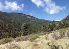
The Colorado Trail crosses here. On the left side of the road it can be picked up near a parking area just behind the railroad renovation. To the right, it is in the campground area. The section to the left is an extremely easy walk for the first 2 miles at least. Most of this walk is through aspens. About 1.7 miles back are outcrops of the Lost Creek Road Porphyry. |
|
Updated 04/24/03.
 1
1


 3
3